OpenReel — Fishing Intelligence
30.158° N  85.660° W · Northern Gulf · Live

Fishing forecasts for the Florida Panhandle

Built by captains, backed by data. Daily spot scoring, species bite windows, and marine conditions for the Gulf Coast, gathered in one place so you can plan a trip around the forecast.

Get the app → Write to us
Scored daily
Reefs · wrecks · ledges
Bite windows
Timed per species
Private spots
Encrypted end-to-end
Status
Now on the App Store
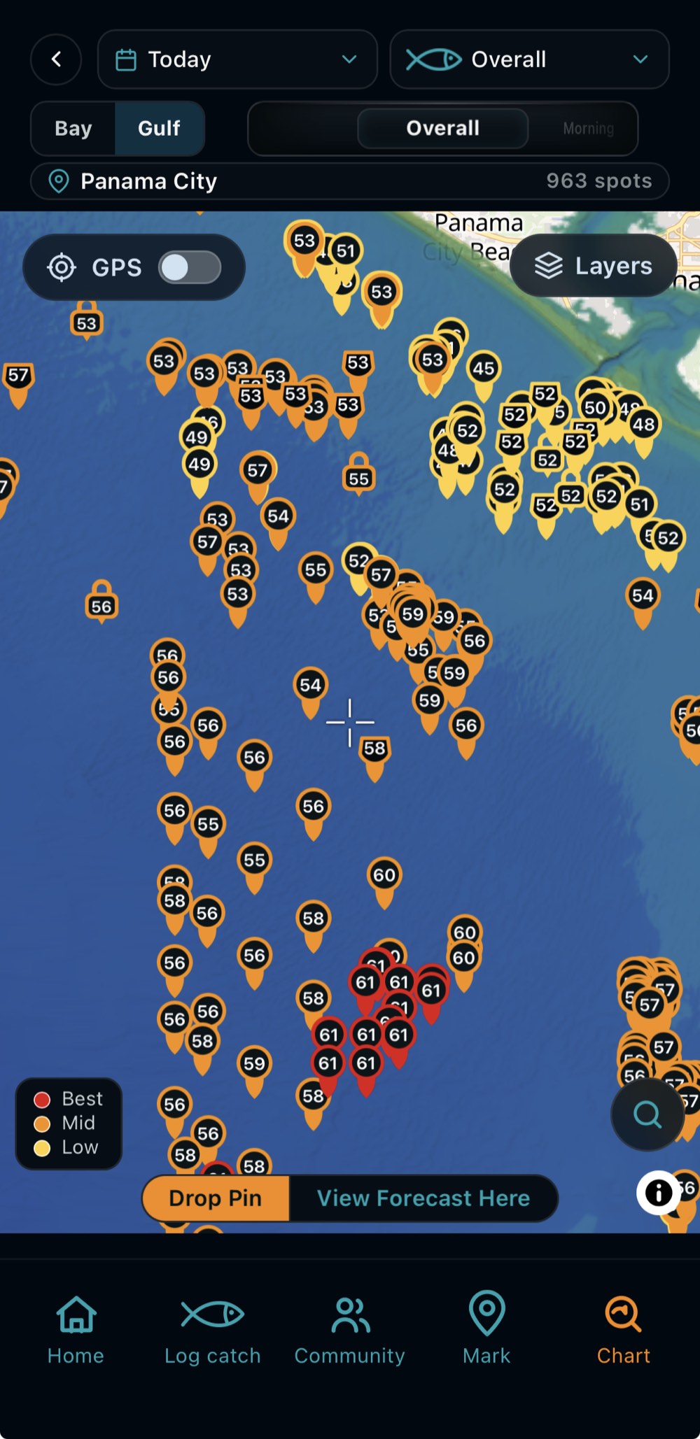
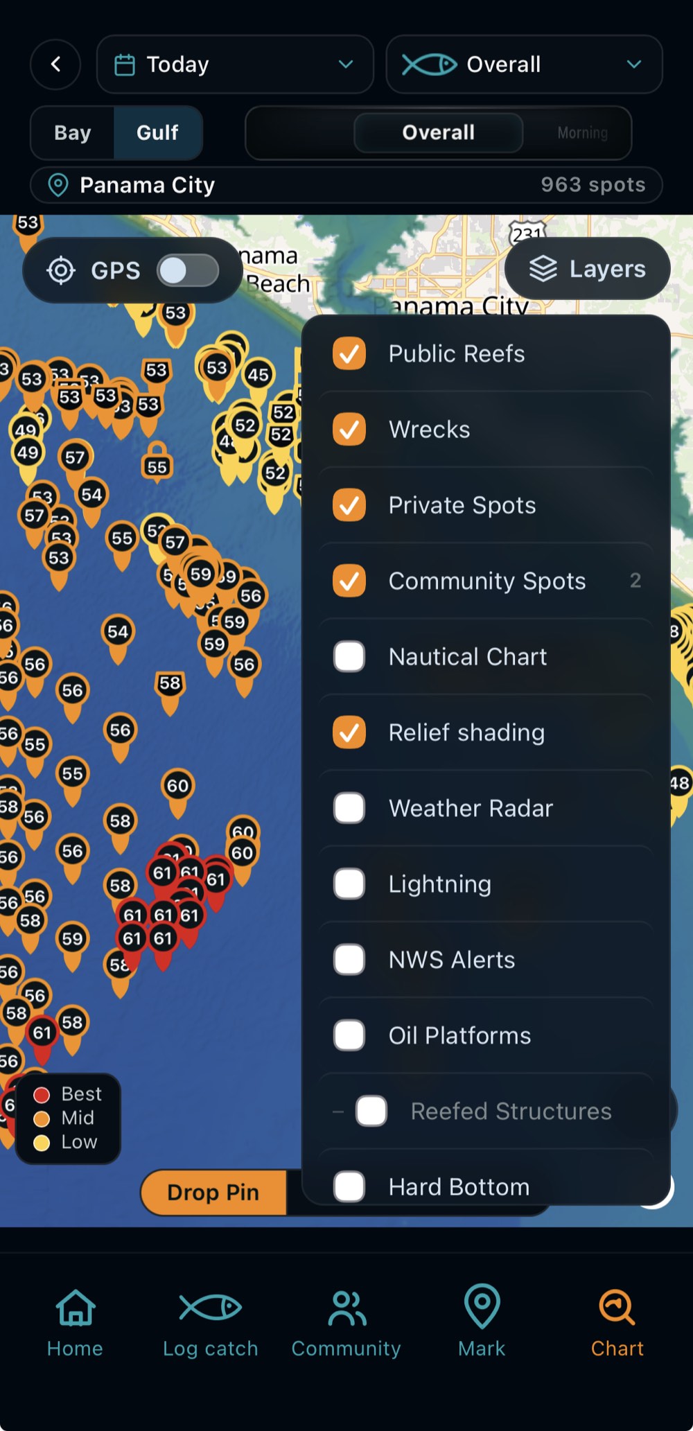
OpenReel spot map — 963 scored spots off Panama City
01 — What OpenReel is

A planning tool, not a guess

OpenReel is a fishing-forecast platform for the Florida Gulf Coast. Every day it scores gulf reefs, wrecks, and ledges — and the entire bay, hex by hex — against the conditions each species actually responds to — water temperature at depth, tide and current, pressure trend, wind and sea state, bottom type, and moon phase.

The result is a planning tool. You see what the data says about a spot on a given day, next to the marine forecast and your own private numbers, and you decide what to do with it.

Water temp at depth Tide & current Pressure trend Wind & sea state Bottom type Moon phase

What's inside

02 — The app
01

Daily spot scores

Gulf reefs, wrecks, and ledges ranked by species — and the whole bay scored, day by day.

02

Bite windows

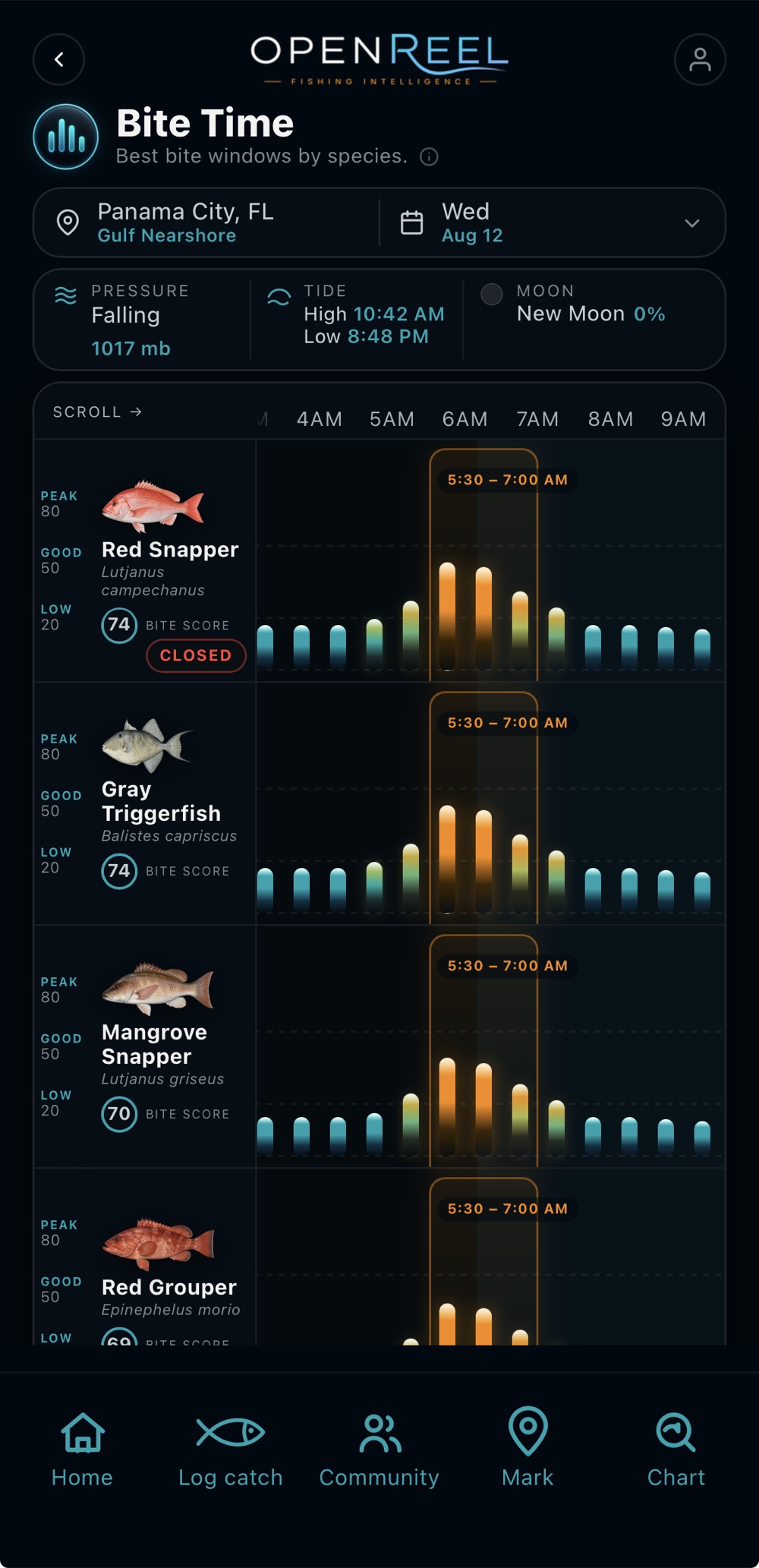
Solunar periods blended with the day's conditions, timed per species.

03

Marine weather

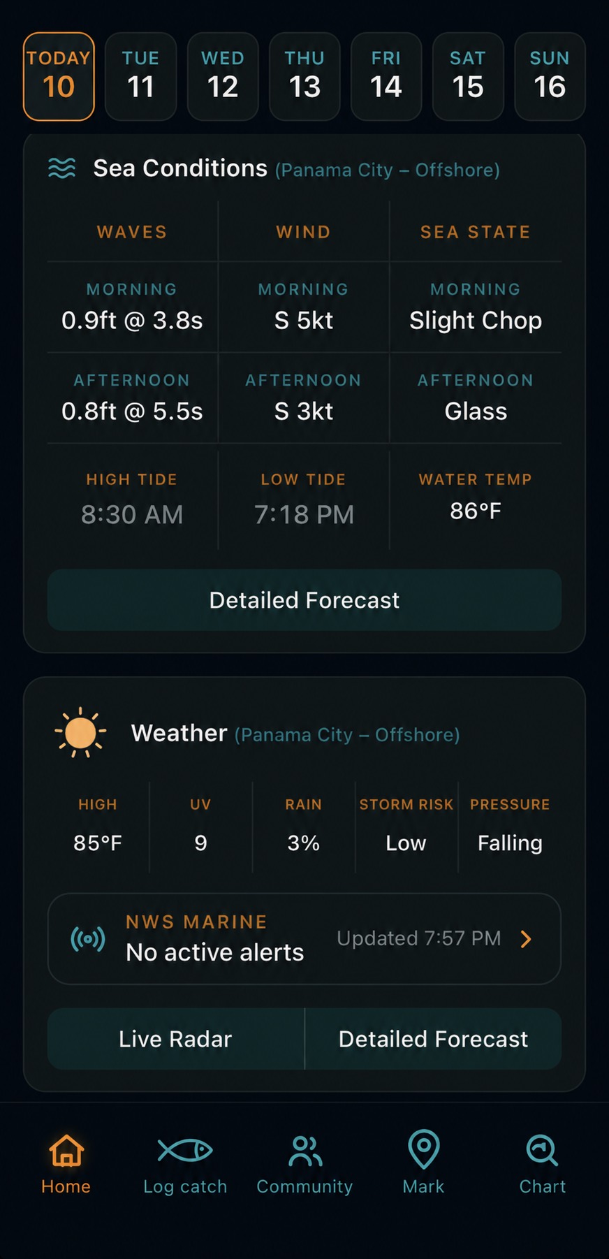
Wind, waves, tides, pressure, storm risk, and NWS marine alerts in one view.

04

Private spots

Your numbers are encrypted end-to-end — coordinates never leave your device unencrypted.

05

Chart layers

Depth, bottom relief, hard bottom, artificial reefs, and navigation markers — plus live radar and lightning.

06

Regulations & catch log

Gulf season, size, and bag references beside the trips you have logged.

On the water, in your hand

iOS · App Store
Sea conditions
Sea conditions
Waves, wind, sea state, tides, and water temp for the day you pick.
Bite Time
Bite Time
Best bite windows by species, against pressure, tide, and moon.
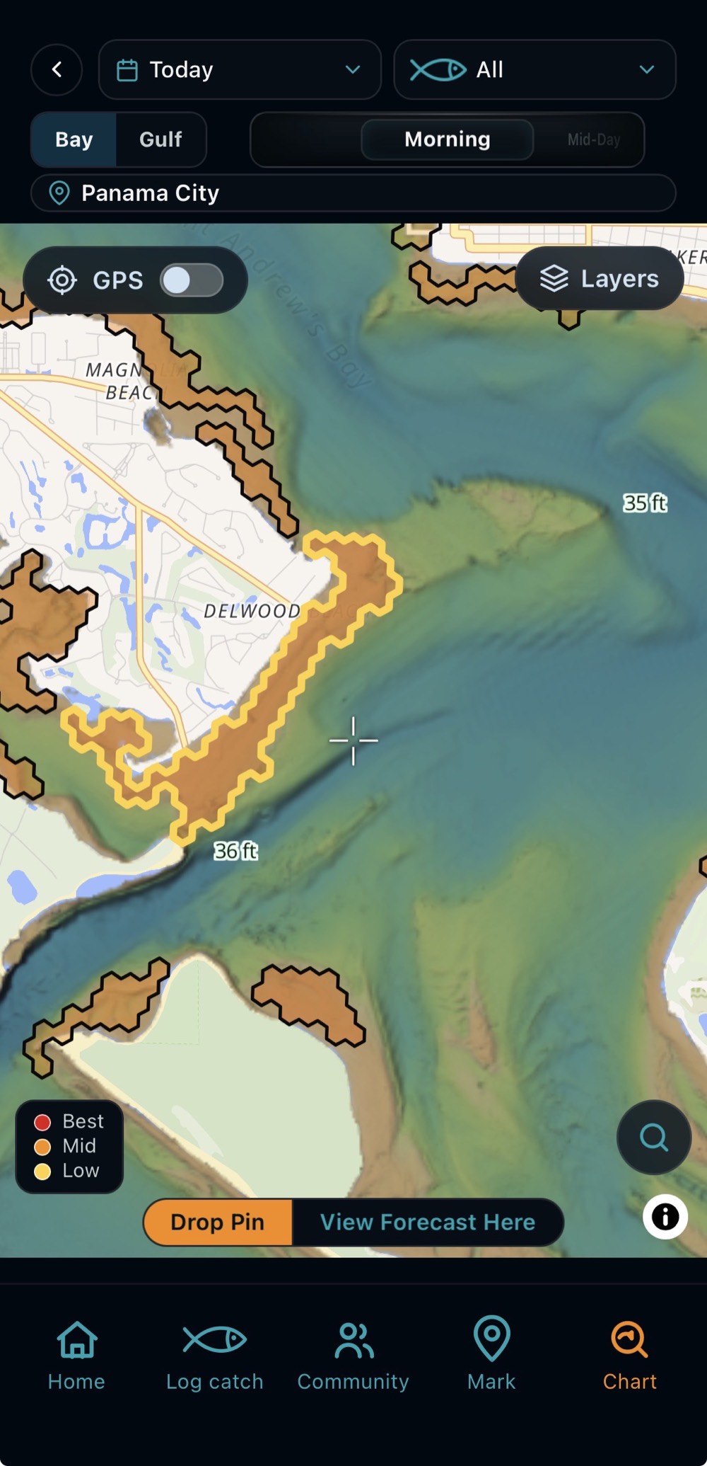
Bay chart
Bay chart
Depth and relief shading across St. Andrews Bay — and the entire bay scored, hex by hex, on a fine H3 grid.
Chart layers
Chart layers
Reefs, wrecks, private and community spots, radar, and alerts.
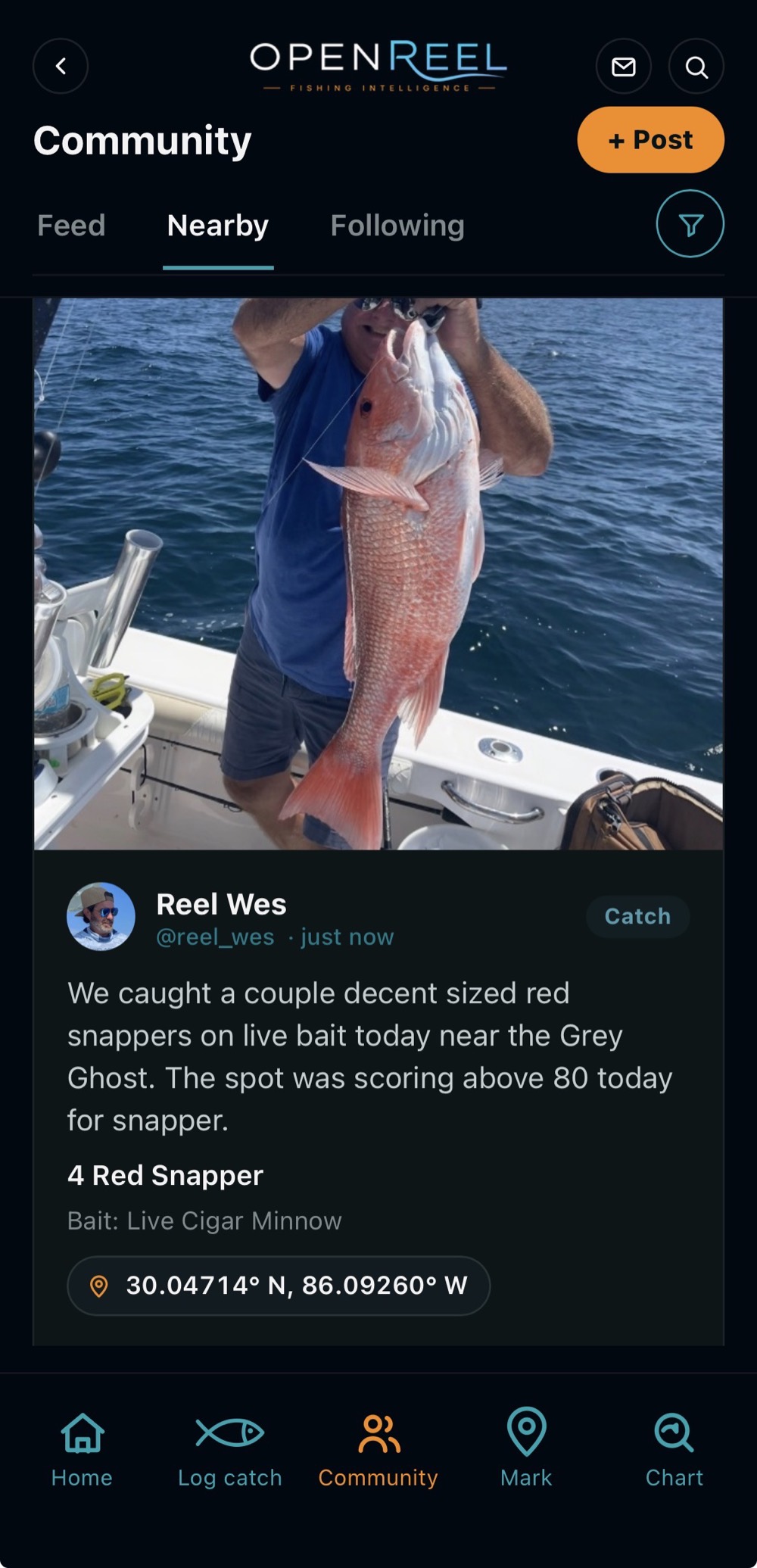
Community
Community
Share a catch, a tip, or a spot — ask questions and trade recommendations with the fleet.
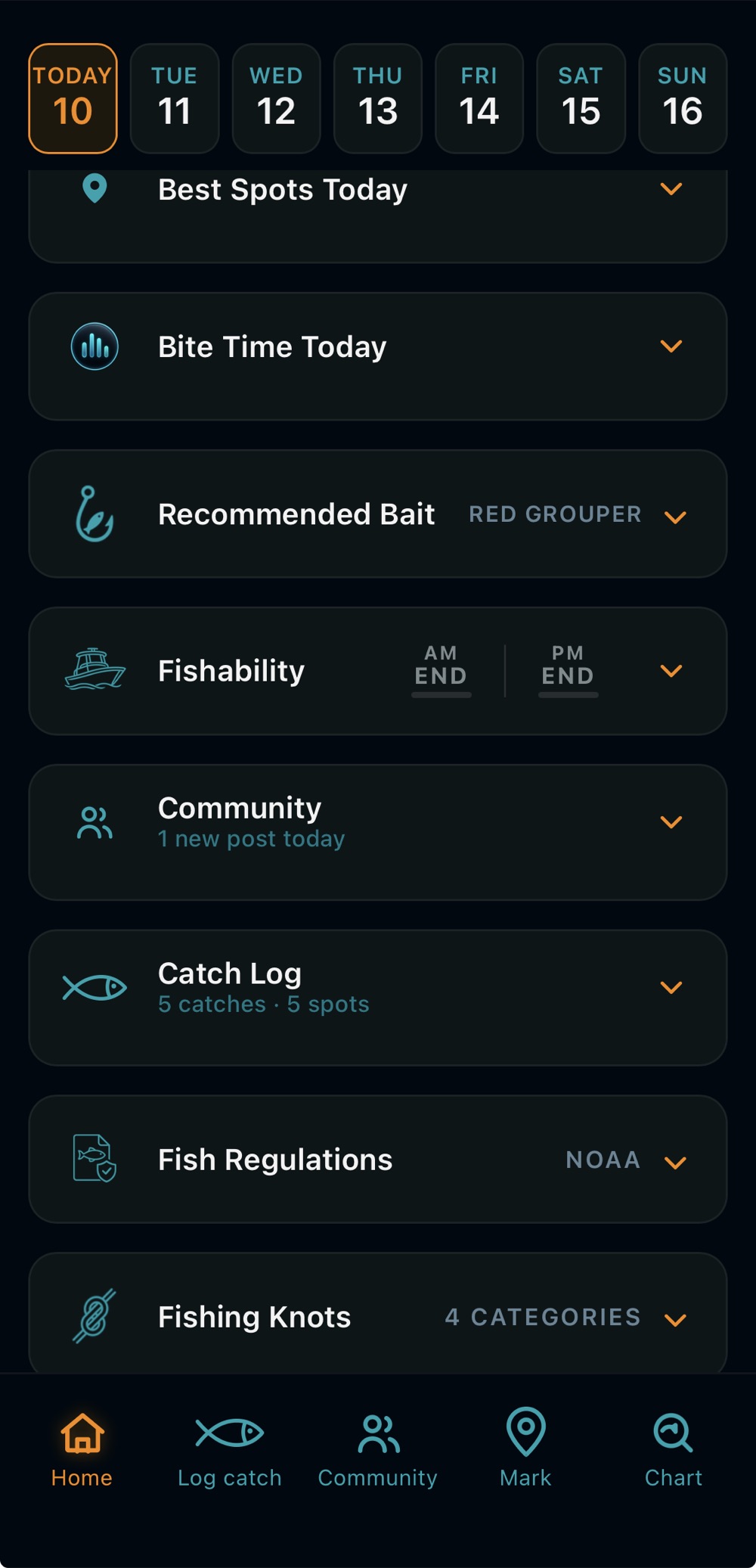
Home dashboard
Your day, at a glance
Best spots, bite time, bait, fishability, and the catch log in one stack.
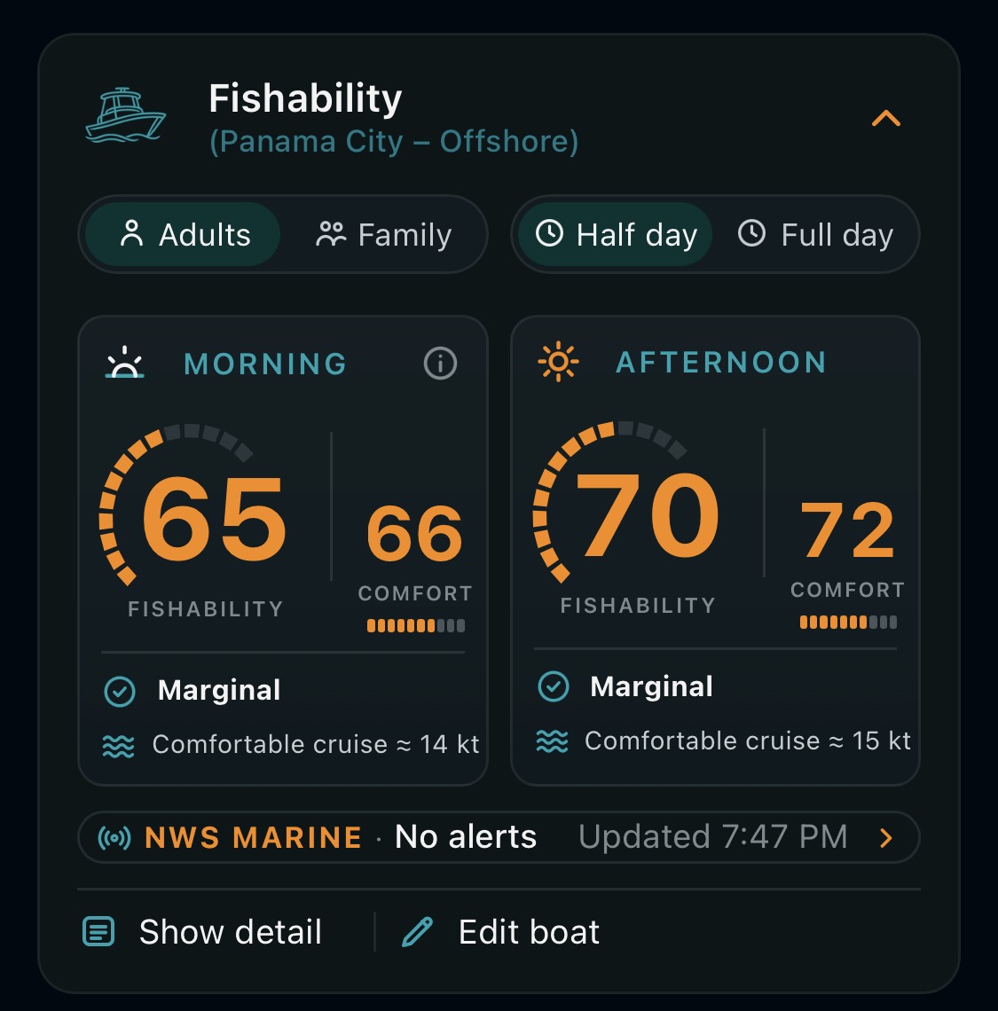
Fishability score card
Fishability — sea state read against your boat and crew, morning and afternoon, with NWS marine alerts alongside.
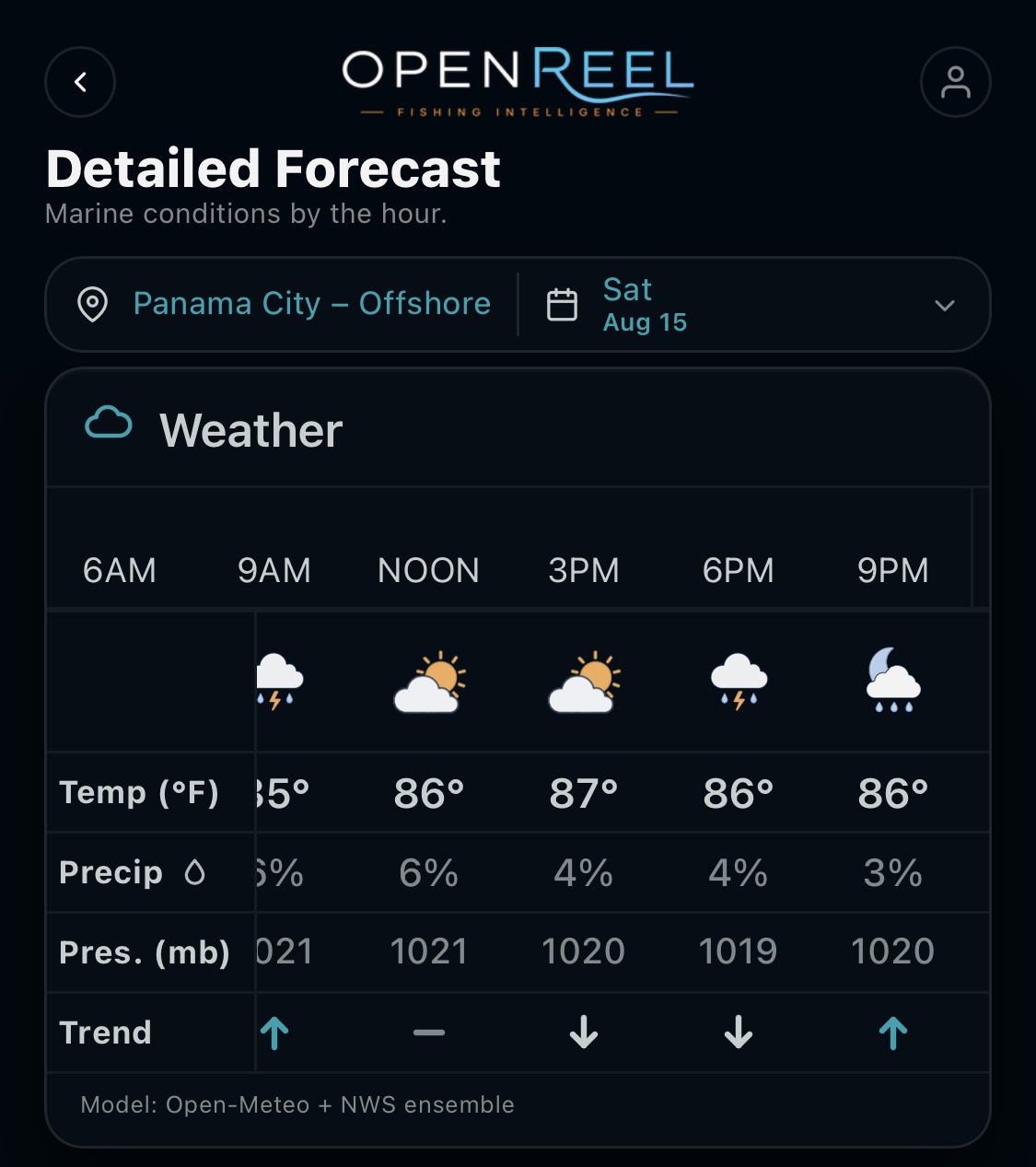
Hourly marine weather forecast
Hourly weather — temperature, precipitation, and pressure trend by the hour, out through the week.
Map layers

Everything on the water, on the chart

Toggle points of interest on the map to plan the whole trip — where to launch, where to top off, where to grab bait, and the structure worth running to.

Boat launches Boat launches
Fuel docks Fuel docks
Live bait Live bait
Marinas Marinas
Waterfront dining Waterfront dining
Oil platforms Oil platforms
Reefed platforms Reefed platforms
Scored private spots Scored private spots
Scored community spots Scored community spots
Scored wrecks Scored wrecks
Scored public reefs Scored public reefs
Live GPS Live GPS
Day & night

Readable at noon, easy at 4 AM

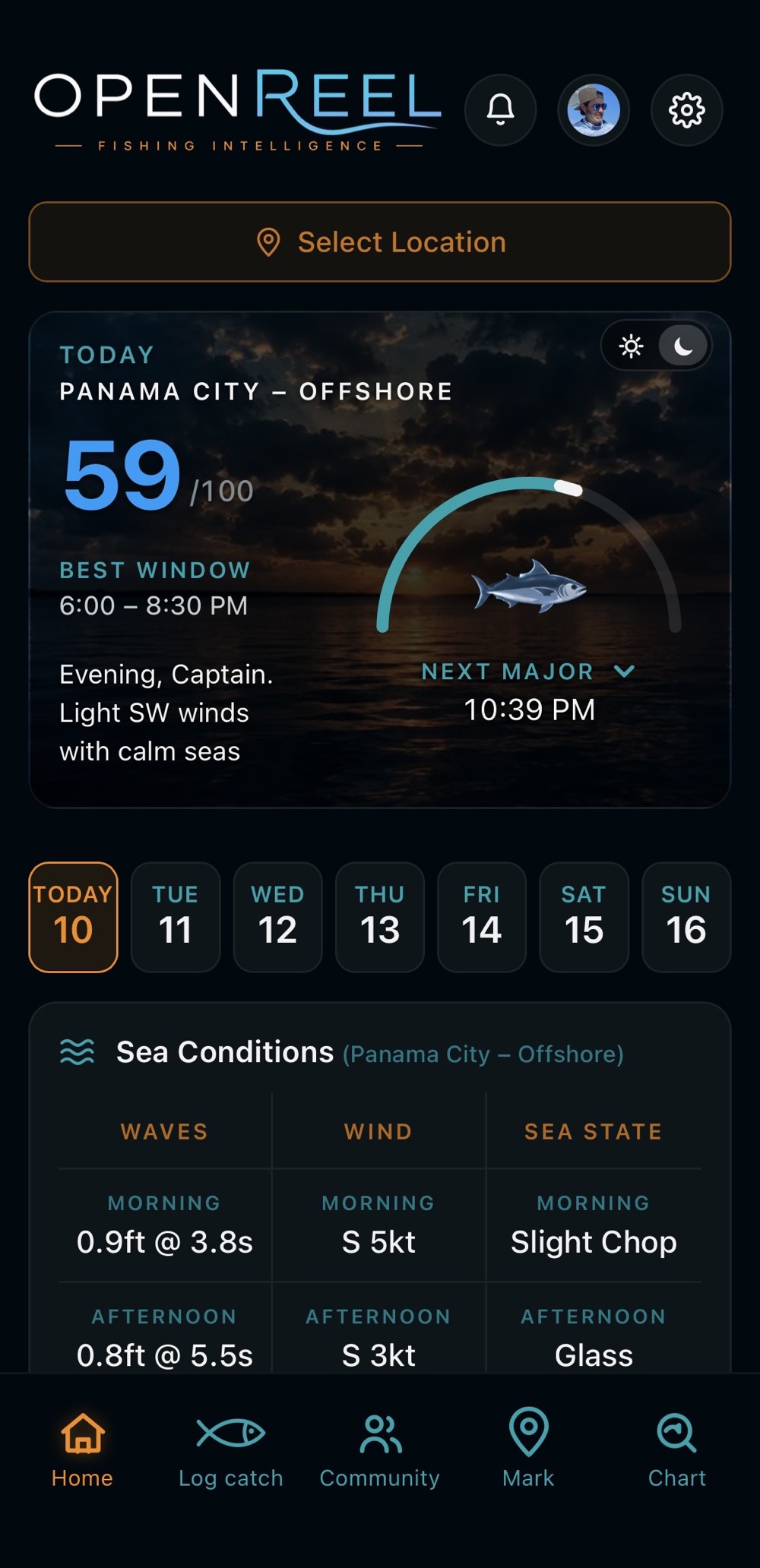
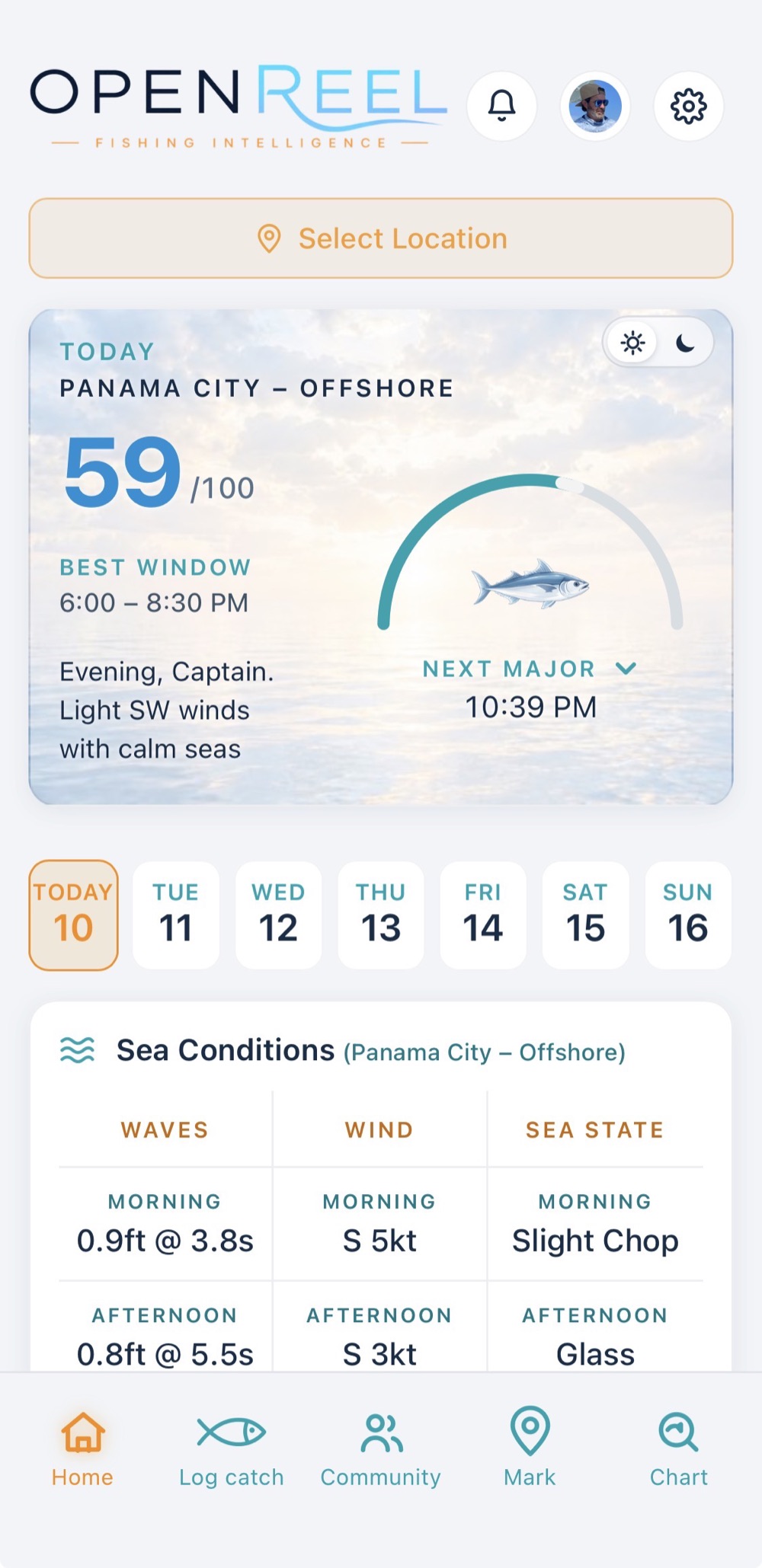
Light mode holds up in direct sun on an open deck. Dark mode keeps your night vision on a pre-dawn run. Drag the handle to compare.

OpenReel home screen in dark mode
OpenReel home screen in light mode
‹›
03 — Coverage

Today and ahead

OpenReel was built region-first: every new water plugs into the same scoring, weather, and bite models that run the Panhandle today. Adding a region is a rollout, not a rebuild — the template is proven, and it's scaling.

  1. Live today

    Northern Gulf — Pensacola to Apalachicola

    Offshore reefs, wrecks, ledges, and hard bottom across the Panhandle gulf, plus full inshore coverage of St. Andrews Bay.

  2. Expanding now

    Choctawhatchee Bay & Pensacola Bay

    Inshore buildout in progress on the same bay engine that scores St. Andrews.

  3. Up next

    The full Florida coast

    Gulf and Atlantic, region by region.

  4. On the horizon

    The coastal United States

    Same template, new water.

OpenReel app icon
04 — Availability

OpenReel is on the App Store

The iOS app is available now on the App Store. Questions, feedback, or anything else — write to admin@openreel.fish.

Write to us